The freedom I feel when I ride my bike is unmistakable and, much like a full moon on a clear night, can’t be fully captured. If you’ve ever spent time behind the handlebars of a bicycle, you’ve probably experienced this phenomenon too. Maybe it’s feeling the wind against my face and smelling fresh cut grass as I ride on my favorite trail in the summer. Maybe it’s the meditative inertia of pedaling or maybe it’s just my cute little bicycle bell that I ring every time I pass someone on route. Regardless of what it is, I’m thankful for all the rides I’ve taken and the countless miles of trails ahead.
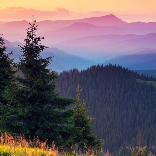
America is chock full of so many scenic bike trails. Some of these beautiful paths can be found in your city and are frequented by commuters, leisure cyclists, and tourists. Others are rugged and winding woods or parks and best visited by experienced bike riders. Better still are the rail-trails built from decommissioned railroad corridors that have been converted to multi-use public trails – a movement that started in the 60’s in the Midwest before spreading across the country like wildfire. Before you tune up your cycle and set out on one of the below trails this summer, make sure to invest in a good helmet and lather on plenty of sunscreen.
Banks-Vernonia State Trail
Situated in Northwest Oregon, the Banks-Vernonia State Trail is the first linear rail-trail in the Beaver state. It runs for 21-miles north to south from Vernonia to Banks, the latter of which is roughly 31 minutes from Portland by car. Along the ride, you’ll pass through lush forests, honey-yellow meadows and more than 12 bridges, including the massive Buxton Trestle, a former railroad bridge once used to carry everything from timber to freight and passengers. The Banks-Vernonia is approachable and largely flat for cyclists of all abilities. Though the trail connects to rugged mountain biking paths in L.L. Stub Stewart State Park, if you’re up for a challenge. You can fish along the way or grab a beer at Hop Cycle Brewing Company in Banks before heading back to Portlandia.
Burke-Gilman Trail
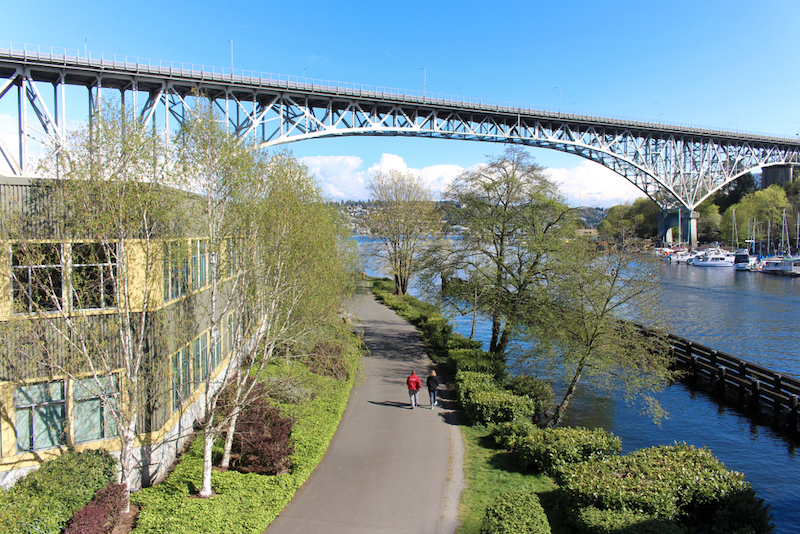
One of the best ways to get a feel for Seattle is behind a set of handlebars on the Burke-Gilman Trail. The 27-mile rail-trail spans 27-miles in the city and beyond to the greater King County area. Start your ride at the trailhead near Ballard’s Shilshole Bay and follow the Fremont Cut before making your way through the University of Washington campus in Bothell, where the trail ends. Along the way, you can stop at Gasworks Park to check out the city’s former gasification plant and take in sweeping views of the Seattle skyline over Lake Union. The trail continues to wind past houseboats and neighborhoods, giving you a view into the city beyond Pike Place Market. Take a break at the appropriately-named Burke-Gilman Brewing Company and order one of their hoppy Saisons.
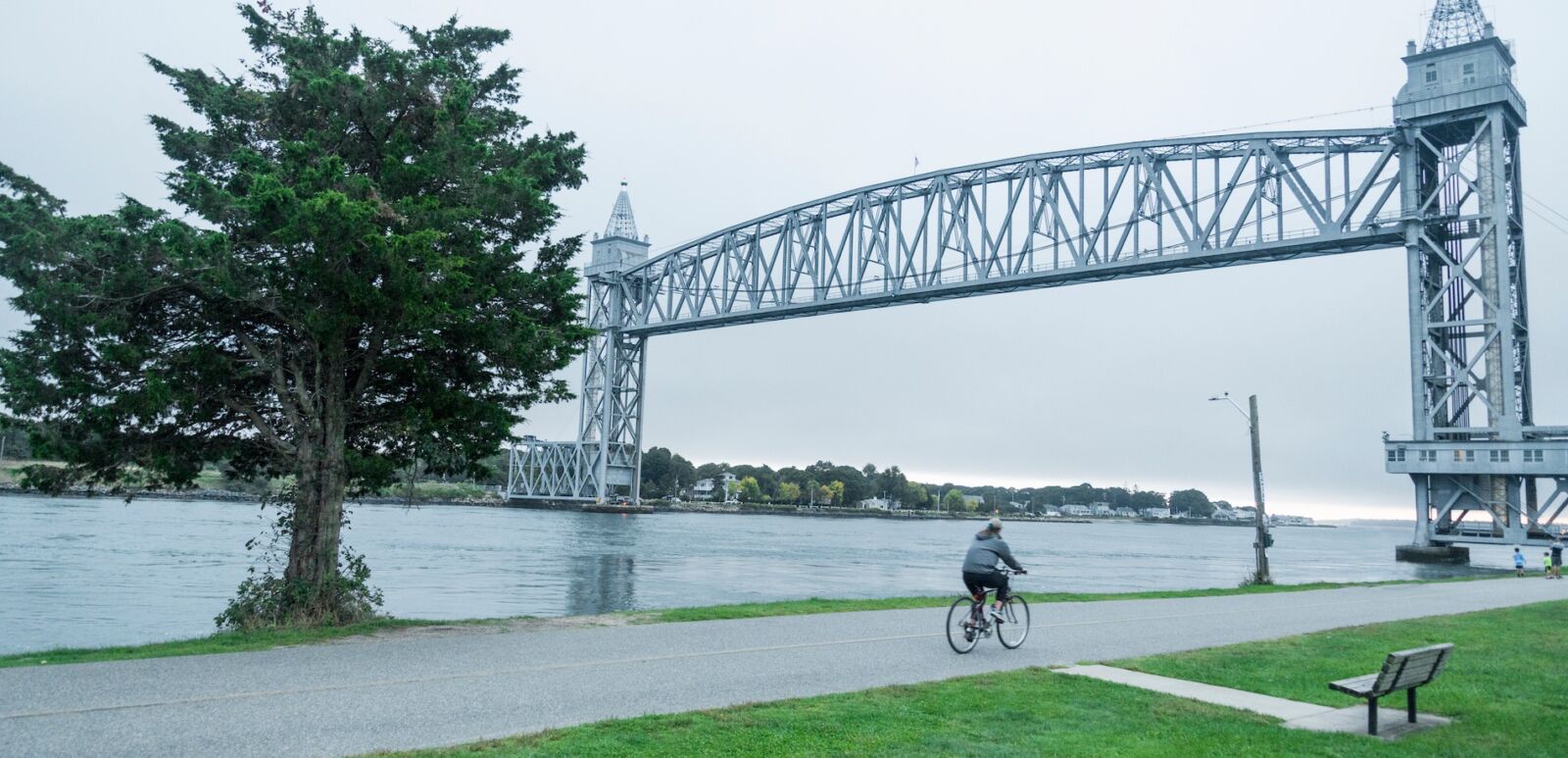
Cape Cod Rail Trail
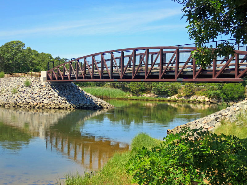
If you want to explore Cape Cod beyond the beach, you gotta hit the Cape Cod Rail Trail. The 25-mile paved path was repurposed into a trail care of an abandoned railroad constructed in the mid-1800’s and now serves as a multi-use pathl that passes through Yarmouth, Dennis, Harwich, Brewster, Orleans, and Eastham before ending in Wellfleet. The flat terrain is popular with families, and will take you through agricultural and wooded land, tunnels, serene ponds and infamous salt marshes. Stop in at Orleans Cycle in downtown Orleans if your bike needs a tune-up and continue along to Eastham where you can chow down on steamed lobster and chowdah at Arnold’s Lobster and Clam Bar beginning on May 19. While the Cape Cod Rail Trail doesn’t follow the coast, you’re just a short ride away from trails that lead to the national seashore beaches. Tickets for the trail cost $5 for residents and $20 for non-residents.
Chicago Lakefront Trail
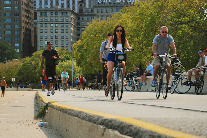
Queue up “Lake Shore Drive” by Aliotta Haynes Jeremiah because the Chicago Lakefront Trail has us feeling some type of way. While we’re not exactly slippin’ on by on LSD, the Chicago Lakefront Trail isn’t far from the iconic thoroughfare and has scenic vistas that rival what you’d see from the passenger seat of a Honda. What the 18-mile long trail lacks in forests it makes up for with unparalleled panoramic views of Lake Michigan on one side and the Chicago skyline on the other. The multi-use trail is paved and hugs the lake for much of the way and is especially nice in the summer when you can hop off your bike and take a dip at any one of the six beaches on the trail. The trail runs north to south and passes by Lincoln Park Zoo and Shedd Aquarium. The Dock at Montrose Bay is a go-to for post-ride sandwiches, salads, tacos, and cocktails.
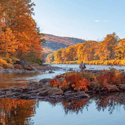
Farmington Canal Heritage Trail
Divided into three sections in Connecticut and Massachusetts, the Farmington Canal Heritage Trail offers views of New England’s green spaces on a predominantly flat trail for bike riders of all levels. The rail-trail was built on a former rail bed and runs from New Haven to Plainville, Connecticut, Farmington to Suffield, Connecticut, and Southwick to Northampton, Massachusetts where the trail ends, totaling approximately 84 miles. From New Haven to Tariffville, Connecticut, the trail is also part of the East Coast Greenway, a path in construction that will eventually link Maine to Florida. Plan on riding beneath the shade of leafy trees and past bucolic landscapes along the historic trail in the summer, or come back in autumn when the leaves turn vibrant shades or orange, yellow, and red.
Going-to-the-Sun Road
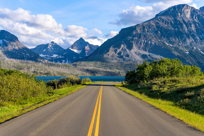
With a name like Going-to-the-Sun Road, you know you’re in for a resplendent voyage. The road runs east to west through Glacier National Park in Montana and was named after the Going-to-the-Sun Mountain which can be seen along the way. Since the route is steep and cyclists are sometimes accompanied by cars, the 48-mile long route is for experienced cyclists who like beautiful scenery coupled with a challenge. The road passes Lake McDonald, Trail of the Cedars, and the Weeping Wall waterfall among other notable spots with the stunning Rocky Mountains in the background along the way. The highest point leads to Logan Pass with a staggering elevation of 6,646 feet in case you need to prove something to your local cycle group back home. Entrance to the park is $35 in the summertime. Fun fact: Going-To-The Sun Road was featured in the opening credits of “The Shining” and made a brief cameo in Tom Hanks’s tour de force “Forrest Gump.”
Ke Ala Hele Makalae Trail
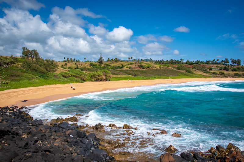
While cycling may not be the first thing that you think of doing whilst visiting Kauai, we recommend carving out a day to explore the Ke Ala Hele Makalae Trail by bike. Situated along the Royal Coconut Coast of the Garden Isle, Ke Ala Hele Makalae is Hawaiian for “The Path that Goes by the Coast,” and cycling past the pristine Pacific is the name of the game here. The palm-tree lined trail is split into two segments totaling eight miles from Lydgate Beach Park to Wailua Beach Park and Kapa’a to Ahihi Point. Since you’re likely visiting Kauai and not checking a bike as luggage,you can rent a bike from Hele on Kauai Bike Rentals in Kapa’a town. The paved path is used for walking, jogging, and skateboarding as well and is a family-friendly way to enjoy oceanic views when on the island. Signage along the way details the historic and cultural significance of places you’ll see.
Walkway Over the Hudson
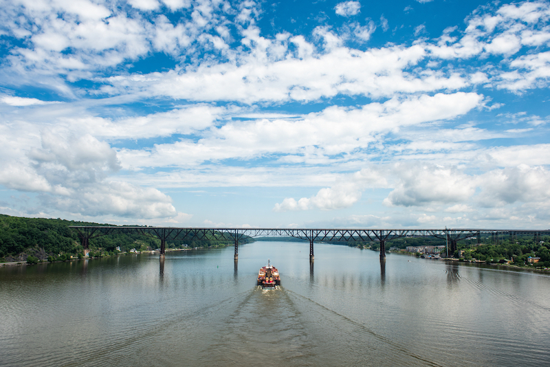
Arguably the shortest trail on our list at just 1.28 miles, the Walkway Over the Hudson is one of the most unique bicycle trails you can visit in the country. Dubbed the world’s longest elevated pedestrian bridge, the Walkway Over the Hudson is a steel cantilever bridge that hovers 212 miles above the Hudson River between Poughkeepsie and Highland, New York. The walkway was originally a railroad bridge before it was decommissioned in 1974 and eventually restored before reopening in October 2009. The bridge is a great place for cyclists of all levels and it offers views of the Catskills. If the voyage over the bridge isn’t difficult enough for you, cyclists can follow the Dutchess Rail Trail on the Poughkeepsie side and the Hudson Valley Rail Trail on the Highland side after making it across.